
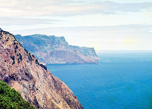
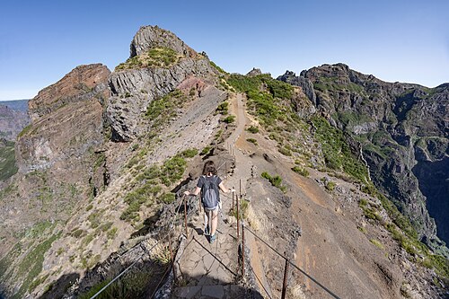
The eastern half packs in the most famous landscapes of the crossing: the Larano cliff path above the ocean, the laurel forest of the Levada do Furado, then the PR1 ridge between Pico do Areeiro and Pico Ruivo.
On the third day, you descend from Pico Ruivo via the PR1.2 to Achada do Teixeira, where a taxi takes you back to Santana or Funchal. It is also the solution while the PR1.3 remains closed towards Encumeada.
Day-by-day plan
| Day | Leg | Distance | Ascent | Descent | Walking time | Overnight |
|---|---|---|---|---|---|---|
| Poço do Gil → Chão das Feiteiras Levada do Furado closed as of November 9, 2026: taxi from Portela to Poiso if needed. | 24.4 km | 1,720 m | 730 m | 8h45 – 10h15 | Chão das Feiteiras and Poiso | |
| Chão das Feiteiras → Pico Ruivo Via Poiso, Pico do Areeiro and the PR1. | 13.5 km | 990 m | 440 m | 5h – 5h45 | Pico Ruivo | |
| Pico Ruivo → Achada do Teixeira via the PR 1.2 – Vereda do Pico Ruivo (Achada do Teixeira) Descent via the PR1.2, then taxi (no bus at Achada do Teixeira). | ≈ 2.8 km | 40 m | 290 m | 1h – 1h | Achada do Teixeira | |
| Total | 41 km | 2,750 m | 1,460 m | |||
Distances and ascent calculated on the waymarked main route; “≈” marks a day on a variant (estimated values). Walking times according to the DIN 33466 standard, without breaks.
The itinerary on the map
one color per dayD1overnight stoprest of the Madeira Crossingvariants
Tips for this itinerary
- The full PR1 ticket (€10.50) includes the PR1.2.
- Climb to the summit of Pico Ruivo (1,862 m) at sunset or sunrise, a few minutes from the camping zone.
The stages in detail
 1
Poço do Gil Chão das Feiteiras
0 m250 m500 m750 m1,000 m1,250 m1,500 m0 km5 km10 km15 km20 km
 2
Chão das Feiteiras Pico Ruivo
1,000 m1,250 m1,500 m1,750 m2,000 m0 km5 km10 km